I have already raved about this product, which brilliantly brings together multiple data to show the ATJ burden and treat from the Hurricane.
So it is great to see that ESRI, a very major GIS-mapping company has honored this project with posting on their Maps Gallery.
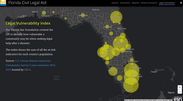
I really have only one point: While the hurricane highlights the power of this tool, really it is just as powerful in every environment. In particular, the pioneering of the LVI , “Legal Vunlnerbility Index,” both makes the data easier to understand, and makes it much more forceful.
I would challenge every ATJ Commission and every IOLTA program, to use these technologies to demonstrate need and impact.
Indeed, I would love to see a national LVI map.
Here is one of the LVI maps from the project.